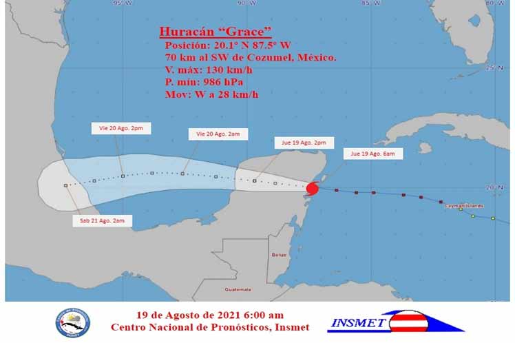
The hurricane center made landfall on the east coast of the Yucatan Peninsula and at 06:00 local time, its position was estimated at 20.1úN and 87.5úW, about 70 kilometers southwest of the island of Cozumel, Mexico, while moving at 28 kilometers per hour.
The Forecast Center of the Cuban Institute of Meteorology (INSMET) reported that the central pressure dropped to 986 hPa and the winds remain at 130 kilometers per hour, gusting to higher values. Grace is a category one hurricane on the Saffir-Simpson scale out of a maximum of five.
The hurricane is expected to weaken into a tropical storm in the next 12 to 24 hours as it enters the Yucatan peninsula and, when leaving the waters of the Gulf of Mexico this afternoon, and is expected to gain in intensity and have a category similar to the current one by the next morning, according to INSMET.
Some precipitations will affect the Guanahacabibes peninsula (Pinar del Río) on Thursday, causing rains the extreme west of the country, while the winds will diminish over the west of the country.
The strong swells will continue in the south of the peninsula with possible coastal flooding in low areas, a situation that will decrease during the morning, and the swells will remain on that coast and in the south of the Isle of Youth until late at night.
pgh/llp/mem/nmr/gdc


