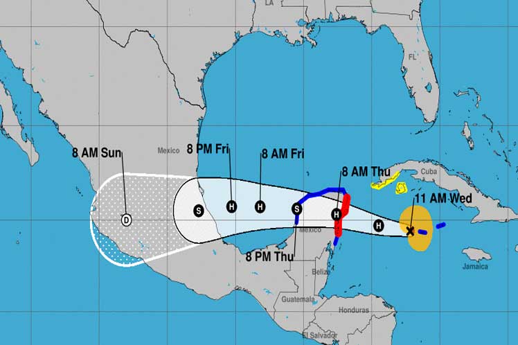
The Forecast Center of the Institute of Meteorology of Cuba (Insmet) reported that the system has a more defined circulation, with an increase in the areas of showers and rains, located at 19.4 degrees North latitude and 82.2 degrees West longitude.The current location is 85 kilometers west of Cayman Grande, in the western Caribbean Sea, and 245 kilometers south-southeast of the Carapachibey Lighthouse, a special municipality of Isla de la Juventud, with a displacement to the west-northwest at 24 kilometers per hour, reported the last warning of the tropical cyclone by Insmet.
In the next 12 to 24 hours, it is forecast that this tropical organism will continue with a course between the west and west northwest, with a similar speed of translation, and will gain in organization and intensity due to the surface temperatures of the sea that in some points exceed 31 degrees Celsius.
It is expected that it will make landfall in the Yucatan peninsula in the early hours of this Thursday.
Showers and rains in the central and western regions, which can be heavy in some localities of Pinar del Río and the special municipality of Isla de la Juventud, are forecast for the rest of the day given the trajectory of Hurricane Grace through the seas south of the Caribbean island.
The winds will be somewhat strong with speeds between 35 and 50 kilometers per hour, up to 60 kilometers per hour in those provinces, with higher gusts, while the swell will increase and light coastal flooding could occur in low areas of Artemisa and Mayabeque.
Specialists warned about the occurrence of strong tidal waves in the Canarreos archipelago, with wave heights of four to six meters, generating light to moderate coastal flooding in low areas of these coasts, the note concluded.
ef/mem/nmr


