In the afternoon yesterday, the Government urged the population and users of maritime navigation to take extreme precautions in states such as Quintana Roo, Campeche, and Yucatan in the coming days due to the rainfall forecast.
The National Maritime Authority anticipates the possible closure of ports in Majahual, Xcalak, and Chetumal, in Quintana Roo, this Friday. Meanwhile, the Surface Water and Rivers Engineering Management maintains special vigilance in the tributaries, dams and towns of Chiapas, as well as the bodies of water and vulnerable areas of Quintana Roo, Campeche and Tabasco.
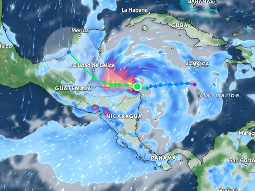
According to the forecast, Sara will continue to move westward today and tomorrow, skirting the coast of Honduras, and beginning Sunday will change direction to the northwest, with a path to Belize and southern Quintana Roo.
The National Weather Service projects that on Sunday afternoon, the tropical storm will make landfall in one of the two named territories, with its current characteristics or as a Category 1 hurricane on the Saffir-Simpson scale.
Mexico City, Nov 15 (Prensa Latina) – Authorities are taking action in response to the advance of Tropical Storm Sara, which is expected to bring heavy to intense rainfall to southeastern Mexico due to its extensive circulation and interaction with other weather phenomena.
Yesterday afternoon, the government urged the public and maritime navigation users to exercise extreme caution in states such as Quintana Roo, Campeche, and Yucatán over the coming days due to anticipated rainfall.
As a result of the storm, the National Maritime Authority is considering the possible closure of ports in Majahual, Xcalak, and Chetumal in Quintana Roo throughout Friday. Additionally, the Surface Water and Rivers Engineering Management is monitoring tributaries, dams, and communities in Chiapas, along with the water bodies and vulnerable areas in Quintana Roo, Campeche, and Tabasco.
Forecasts indicate that Sara will continue moving westward today and tomorrow, skirting the coast of Honduras. Beginning Sunday, the storm is expected to shift to the northwest, with a trajectory towards Belize and southern Quintana Roo.
The National Weather Service predicts that by Sunday afternoon, the tropical storm may make landfall in either Belize or southern Quintana Roo, potentially as a Category 1 hurricane on the Saffir-Simpson scale.
jrr/arm/npg/las


